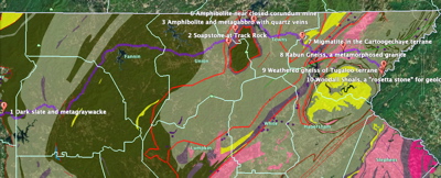
US 76 Road Guide Map
Rock outcrops, numbered in the order mentioned in the US 76 online bonus section written for Roadside Geology of Georgia - from Google Earth.
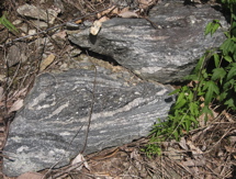
1 Dark slate and metagraywacke
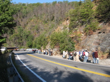
Georgia Geological Society 2007 field trip examines rusty-weathering dark slate and metagraywacke along US 76.
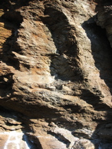
1 Close-up of dark slate and metagraywacke
Close-up of dark slate, rust-stained because of the weathering of pyrite (iron sulfide). Metagraywacke in the bottom left corner bears graffiti on the smooth face left by a joint.
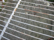
2 Soapstone at Track Rock
Leaf shape carved in soapstone boulder (protected from further carving by grate) at Track Rock. The soapstone is metamophosed ultramafic rock of the Lake Chatuge complex, and probably began as part of Earth's mantle.
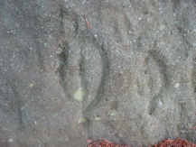
2 Close-up of leaf shaped petroglyph at Track Rock
Close-up of leaf shape carved in soapstone boulder at Track Rock.
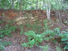
3 Amphibolite and metagabbro with quartz veins
Black, rusty-weathering amphibolite and metagabbro (with white quartz veins) along Swanson Road at US 76.
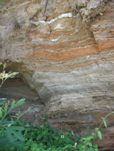
5 Colorful weathered amphibolite and metagabbro
Weathered amphibolite and metagabbro in layers of yellow-brown and gray, at Ridge Crest Circle.
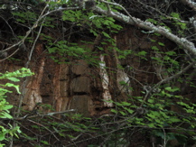
6 Amphibolite near closed corundum mine
Amphibolite at Hog Creek Road, near now-covered Hog Creek corundum mine.
7 Migmatite in the Cartoogechaye terrane
A block of migmatite in the Cartoogechaye terrane, in which the metamorphic gneiss layers grade into igneous texture, where the rock presumably partially melted.